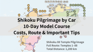
Hello. My name is “Taka,” and I run this blog.
I have completed the Shikoku Pilgrimage on foot, going both clockwise and counterclockwise for two full rounds.
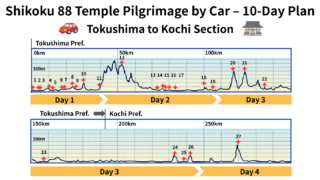
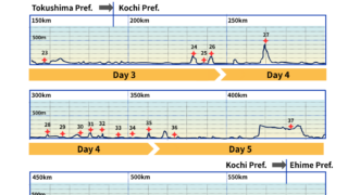
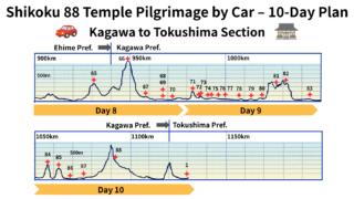
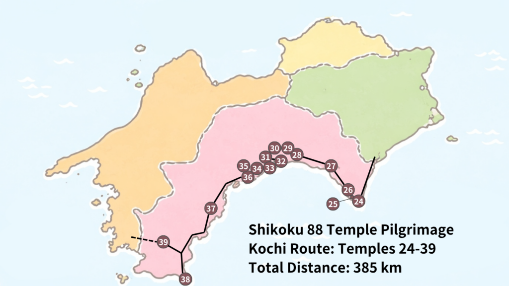
Day 3 of the car pilgrimage is a major travel day from Tokushima to Kochi, heading toward Cape Muroto.
Many people worry about this section, wondering things like:
“Can I finish it in one day?” “Are the mountain roads difficult?” “Where should I stay overnight?”
But in conclusion, if you understand the key points in advance, it is entirely manageable without excessive strain.
In this article, I will clearly explain the route for Day 3 of the car pilgrimage (temples 20–26), including travel time, important cautions, and highlights based on my own experience.
Summary of this article
- Day 3 of the car pilgrimage is a long-distance route from Tokushima to Kochi (Cape Muroto)
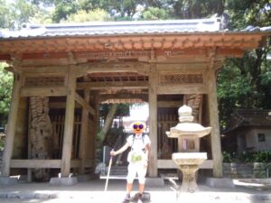
- Temples 20 (Kakurin-ji) and 21 (Tairyū-ji) are mountain temples at about 500m elevation and considered challenging
- Total driving distance is approximately 140 km; especially the stretch from temple 23 to 24 is a long drive of about 75 km
- For Tairyū-ji, consider using the ropeway to save time and physical effort
- Staying in the Muroto area makes Day 4 travel much smoother
- Best Day 3 Schedule (Time Allocation)
- Day 3 of the car pilgrimage: From Tokushima to Kochi, Cape Muroto
- Highlights of Day 3: the spectacular views of the Pacific Ocean
- Roadside Station Information: From southern Tokushima to the Cape Muroto area
- Recommended accommodation: Cape Muroto
- Common mistakes in the Tokushima area
- Frequently Asked Questions (FAQ)
- Summary
- Related Article
Best Day 3 Schedule (Time Allocation)
As a guideline, allocate about 30 minutes per temple for the visit. This is intentionally generous, so you can adjust flexibly depending on the situation.
- 7:30Breakfast & Departure
30 min travel
- 8:00Temple 20: Kakurinji
30 min worship + 20 min travel
- 9:00Ropeway
10 min (round trip: 2,600 yen)
- 9:10Temple 21: Tairyuji
30 min worship + 25 min travel
- 10:05Temple 22: Byodoji
30 min worship + 30 min travel
- 11:05Temple 23: Yakuoji
30 min worship + 2 hr travel
- 12:00Lunch
- 14:30Temple 24: Hotsumisakiji
30 min worship + 15 min travel
- 15:15Temple 25: Shinshoji
30 min worship + 15 min travel
- 16:30Temple 26: Kongochōji
30 min worship
- 17:00Finish
Day 3 of the car pilgrimage: From Tokushima to Kochi, Cape Muroto
On Day 3, you will visit temples 20 through 26.
It is a long day with a total driving distance of about 140 km and many transfers.
Temples 20 and 21 are located in mountainous areas, so caution is required when driving on winding mountain roads.
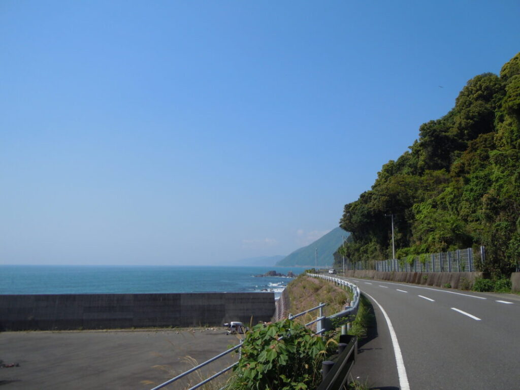
After passing temple 22, the scenery changes completely as you enter a coastal driving route.
This part of the route offers dramatic changes in scenery. You can enjoy both mountains and the ocean, while also experiencing the more challenging and rugged side of nature.
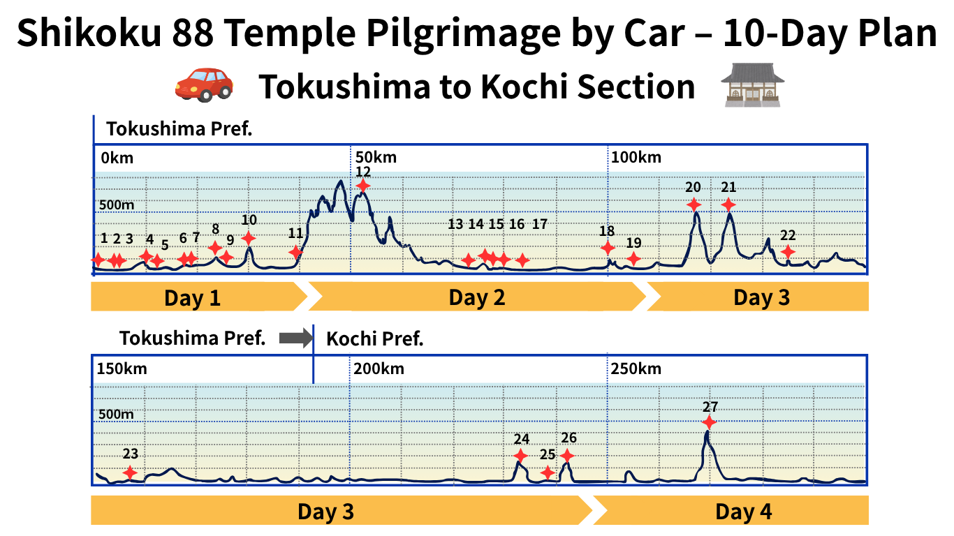
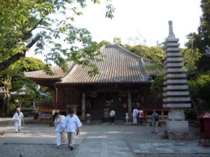
Information on Temples No. 20 to No. 26
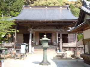
The pilgrimage temples in Tokushima Prefecture continue up to Temple 23, and from Temple 24 onward, the route enters Kochi Prefecture.
A complete list of all temples up to No. 88 is available in the article below.
Temple List and Full Route
Key points of Day 3: steep mountain roads and long-distance travel
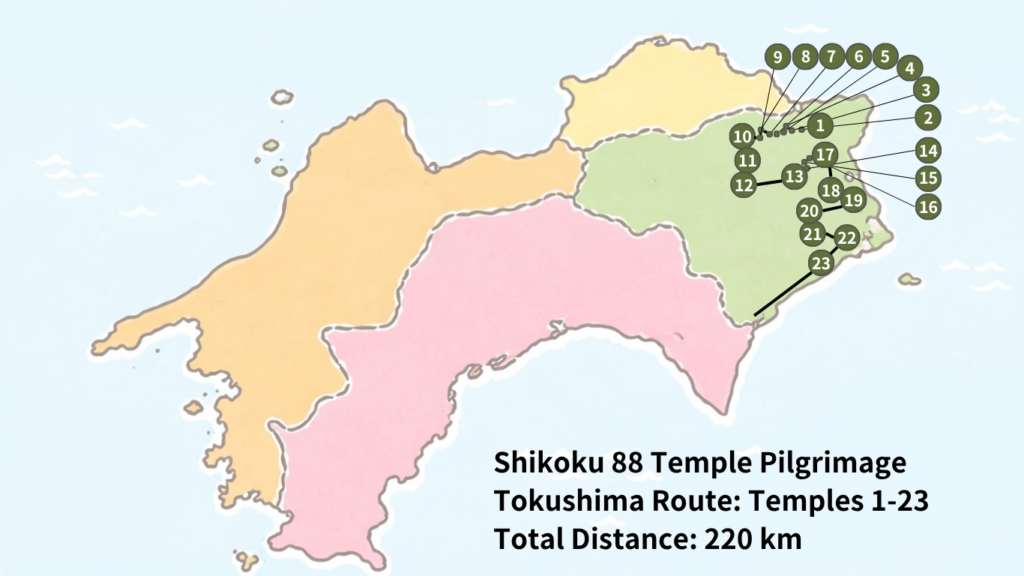
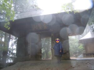
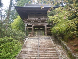
Temples 20 (Kakurin-ji) and 21 (Tairyū-ji) are both mountain temples located at an elevation of about 500 meters.
The route from temple 20 to temple 21 involves descending once and then climbing again, resulting in a total elevation change of roughly 1,000 meters. This section is well known as one of the more challenging parts of the pilgrimage.
How to access Temple 21, Tairyū-ji
There are two main ways to reach Temple 21, Tairyū-ji.
The first option is by car.
You can drive up to the parking area, but from there you will need to walk approximately 200 meters up a mountain path to reach the temple.
This route is manageable for those accustomed to mountain walking, but caution is advised depending on your physical condition and the weather.
The second option is to use the ropeway.
You can board it from the roadside station “Washinosato” (Michi-no-Eki Washinosato).
This is the recommended choice for those who are concerned about their physical stamina.
The round-trip fare is 2,600 yen, and the ride takes about 10 minutes.
Operating hours are from 8:00 to 16:40, with departures every 20 minutes (at :00, :20, and :40 each hour).
If you want a smooth temple visit or simply enjoy the scenery, using the ropeway is highly recommended.
You can check the current operating status of the Tairyū-ji Ropeway on the official website.
Long-distance travel from Temple 23 to Temple 24
The drive to Temple 24, Muroto-misaki-ji, is approximately 75 km, and takes nearly two hours even by car.
There are gas stations around the Cape Muroto area, so you can drive this long stretch with peace of mind.
If you are starting from central Tokushima, it is advisable to plan your accommodation in the Muroto area for this day. Doing so will help you maintain a more balanced and comfortable itinerary without overexertion.
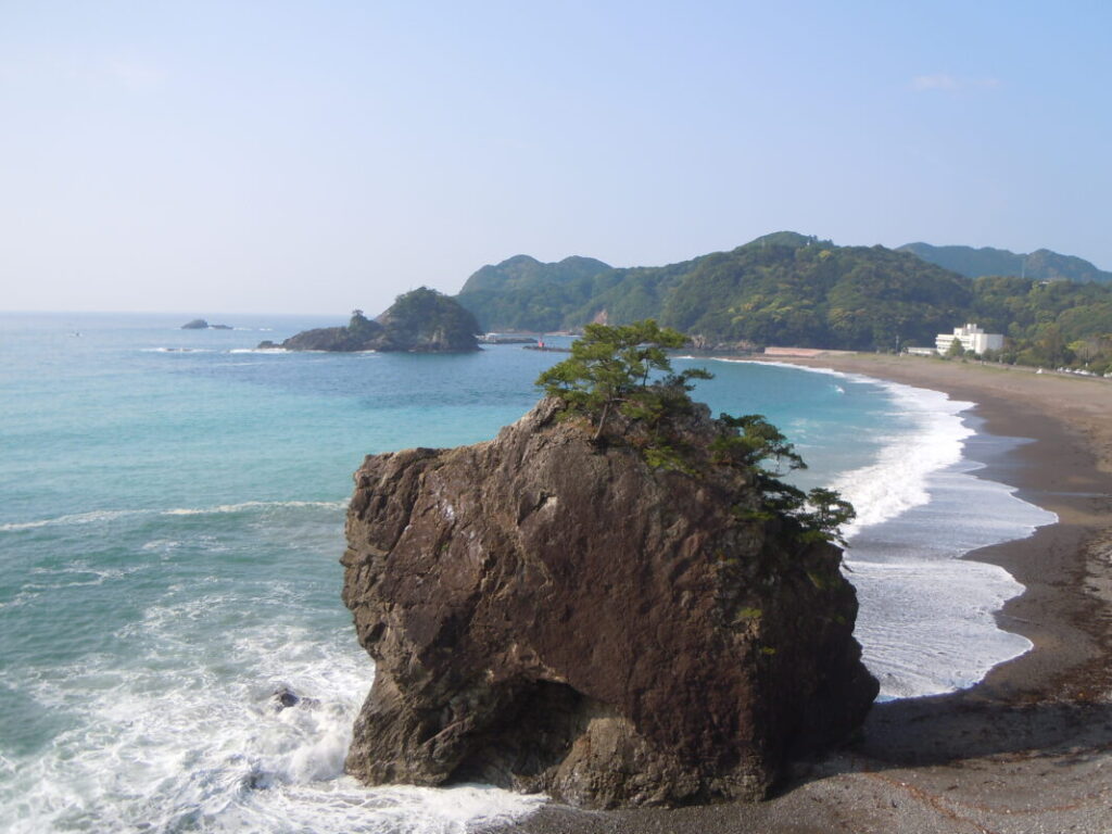
Highlights of Day 3: the spectacular views of the Pacific Ocean
The greatest highlight of this day is the magnificent expanse of the Pacific Ocean.
After crossing the rugged mountain roads, the sea that suddenly comes into view feels especially moving and rewarding.
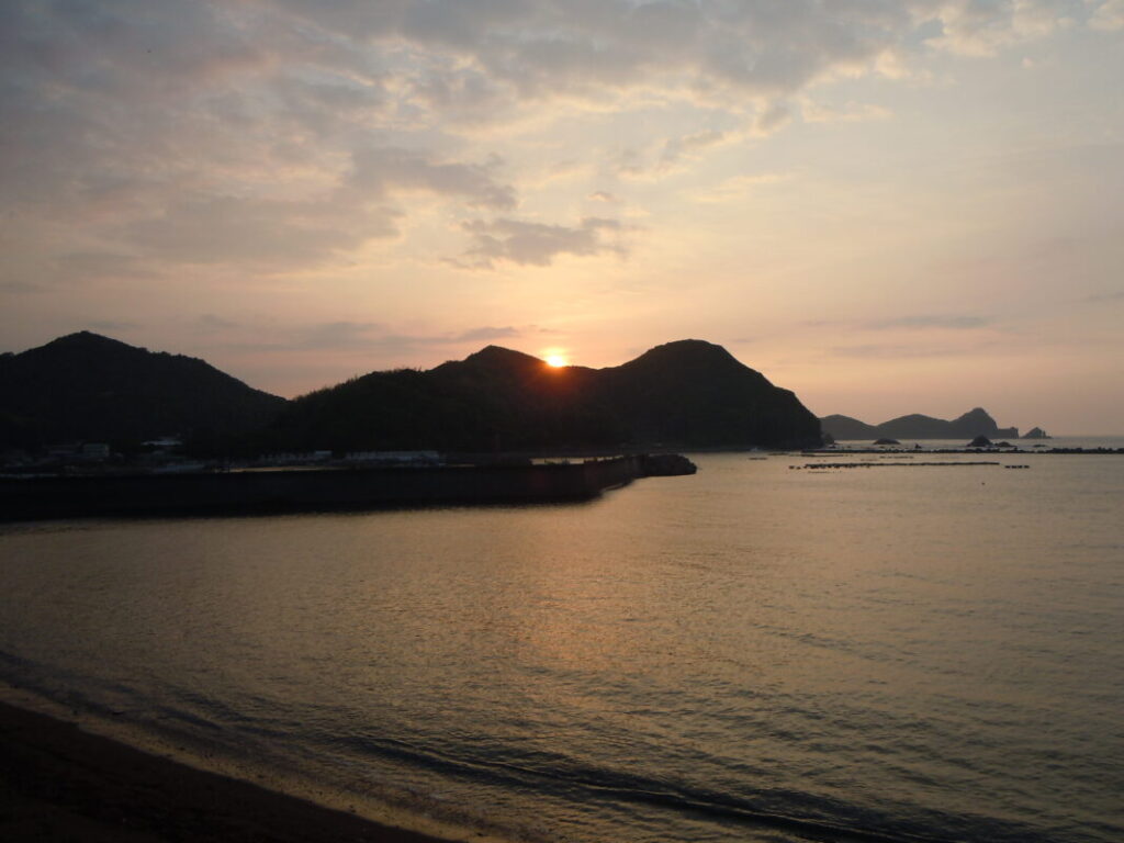
The Muroto area also offers dynamic scenery unique to this region, where mountains and the ocean blend together in a dramatic landscape.
In particular, during sunrise, the sky and sea are bathed in a golden glow, creating a breathtaking view that naturally draws you in.
Recommended spot: Cape Muroto
Mikurodo is a sea cave located at Cape Muroto in Muroto City, Kochi Prefecture, and is closely associated with Kōbō Daishi.
In the Heian period, this was a place where Kōbō Daishi is said to have practiced ascetic training.
During his time here, it is said that a “bright star” flew into his mouth, leading him to attain enlightenment.
Inspired by the view of the sky and sea from this location, he is also said to have taken the name “Kūkai.”
“Kū” means “sky” in Japanese, and “kai” means “sea.”
Mikurodo is also selected as one of Japan’s “100 Soundscapes,” and its appeal lies in the mystical atmosphere created by the sound of waves echoing through the cave.
It was once restricted due to the risk of falling rocks, but safety measures have since been implemented, and visitors are now able to enter the cave again.
Mikurodo
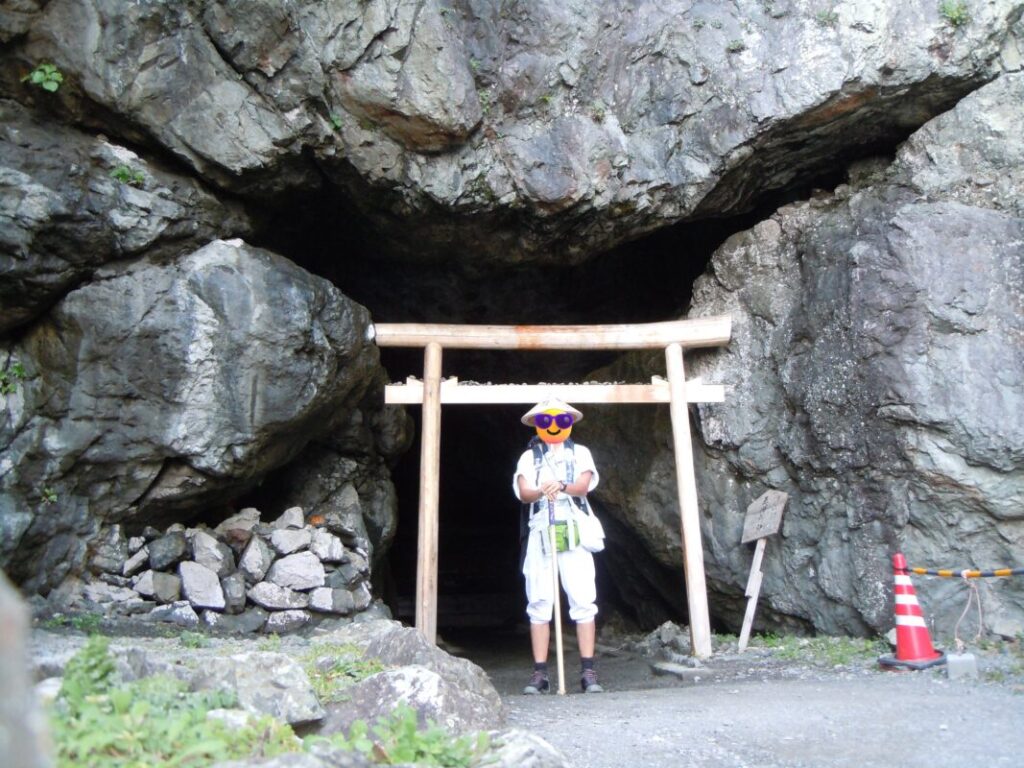
The place where Kūkai attained enlightenment.
Statue of Nakaoka Shintarō
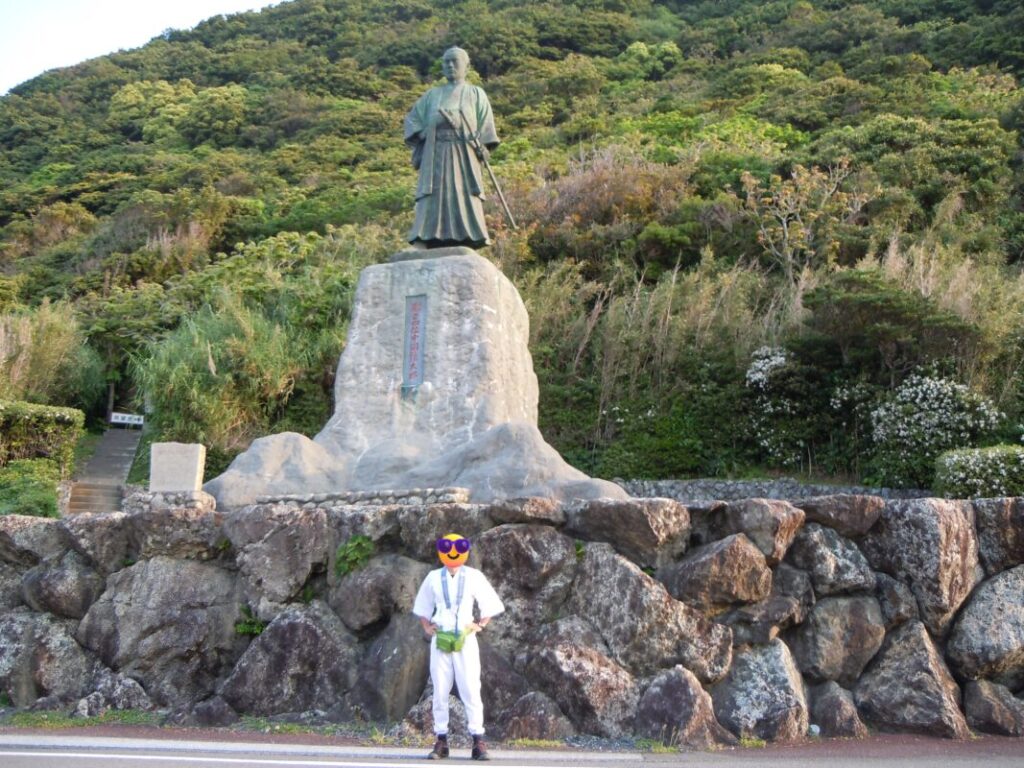
One of the samurai of the Tosa Domain during the late Bakumatsu period.
Roadside Station Information: From southern Tokushima to the Cape Muroto area
We have compiled a list of roadside stations that are easily accessible from the pilgrimage route.
Washi no Sato
| Parking | 150 |
| Nearest Temple | No. 21 |
| Facilities | – |
| Google Maps | MAP |
| Rating | ★★★★☆ (4/5) |
The boarding station for the ropeway to Temple 21, Tairyū-ji, is located here as part of the facility.
Wajiki
| Parking | 20 |
| Nearest Temple | No. 22 |
| Facilities | Wi-Fi |
| Google Maps | MAP |
| Rating | ★★★☆☆ (3/5) |
It is located along National Route 195 and sits midway between Temple 21 and Temple 22, making it a convenient and easily accessible location.
Hiwasa
| Parking | 60 |
| Nearest Temple | No. 23 |
| Facilities | – |
| Google Maps | MAP |
| Rating | ★★★★☆ (4/5) |
This roadside station is located directly in front of Temple 23, Yakuō-ji.
Shishikui
| Parking | 30 |
| Nearest Temple | No. 23, 24 |
| Facilities | Wi-Fi, Hot spring |
| Google Maps | MAP |
| Rating | ★★★★★ (5/5) |
It is located midway between Temple 23 and Temple 24.
Another welcome feature is that you can use the hot spring bath for 800 yen.
Toyocho
| Parking | 160 |
| Nearest Temple | No. 23, 24 |
| Facilities | Wi-Fi, Shower |
| Google Maps | MAP |
| Rating | ★★★★★ (5/5) |
The ocean stretches out right in front of it, creating an open and refreshing setting. The food is also well regarded, and the tuna set meal is especially outstanding.
Muroto
| Parking | 80 |
| Nearest Temple | No. 26 |
| Facilities | – |
| Google Maps | MAP |
| Rating | ★★★★☆ (4/5) |
It is located at the foot of Temple 26, Kongōchō-ji, making it a convenient place to stop before or after your visit.
Here is a list of roadside stations (Michi-no-Eki) convenient for the Shikoku Pilgrimage.
Best roadside stations for Shikoku pilgrims
Recommended accommodation: Cape Muroto
Recommended Stay: Guesthouse Yorozuya
Guesthouse Yorozuya is a budget-friendly and comfortable stay in the Muroto area, ideal for pilgrims traveling by car with easy access to Temples 24–26 as a base for Day 3 or Day 4.
Known for its warm hospitality and relaxed atmosphere, it is popular among pilgrims, and its location near Cape Muroto also offers beautiful ocean views and sunrise scenery.
Other recommended accommodations are explained in detail in this article.
Common mistakes in the Tokushima area
“I should have used the ropeway for Tairyū-ji”
Because the walk from the parking area to the main hall involves a steep uphill climb, the physical burden can be significant, especially under the following conditions:
- Hot summer weather
- Rainy or poor weather conditions
- Winter season with possible icy roads
To avoid unnecessary strain, it is worth considering using the ropeway.
“Missing the operating hours of the Tairyū-ji Ropeway”
If you do not check the operating schedule in advance, there is a risk of missing the ropeway and having your entire itinerary disrupted.
Operating hours:
- 8:00–16:40
- Departures every 20 minutes (at :00, :20, and :40)
- Ride time: approximately 10 minutes
- Last departure: 16:40
Considering temple visit time, it is safest to board no later than the 16:00 departure.
Frequently Asked Questions (FAQ)
- QCan Kakurin-ji (Temple 20) and Tairyū-ji (Temple 21) be accessed by car?
- A
Yes, both temples are accessible by car. However, since mountain roads are involved, caution is required for those who are not confident in their driving skills.
- QShould I use the ropeway for Tairyū-ji?
- A
If you have limited time or physical stamina, using the ropeway is recommended. The walk from the parking area to the main hall includes a steep uphill climb, which can be especially demanding in summer heat, bad weather, or winter conditions.
- QWhat are the operating hours of the Tairyū-ji Ropeway?
- A
The ropeway operates from 8:00 to 16:40, with departures every 20 minutes (at :00, :20, and :40).
Since the final departure is at 16:40, it is recommended to board no later than around 16:00 to avoid missing it.
- QHow difficult is the drive from Temple 23 to Temple 24?
- A
The distance is about 75 km, and it takes approximately two hours by car. This is the most time-consuming section of Day 3.
- QAre there gas stations available?
- A
Yes, there are gas stations around the Cape Muroto area.
- QWhere is the best place to stay overnight?
- A
Staying in the Muroto area is recommended for Day 3. It provides good access to Temples 24 (Hotsumisaki-ji), 25 (Shinshō-ji), and 26 (Kongōchō-ji), and makes the Day 4 itinerary smoother.
- QWhat is the highlight of this day?
- A
The main highlight is the coastal scenery leading to Cape Muroto. The view of the Pacific Ocean after crossing the mountain roads is one of the most memorable parts of Day 3.
Summary
Day 3 of the car pilgrimage (Temples 20–26) is a long-distance route with significant variation, combining both mountain roads and coastal driving.
In particular, Temples 20 (Kakurin-ji) and 21 (Tairyū-ji) are located at higher elevations and are considered challenging due to both driving conditions and the physical demands of the pilgrimage. To avoid unnecessary strain, it is important to consider using the ropeway and starting the day early.
Additionally, the stretch from Temple 23 (Yakuō-ji) to Temple 24 (Hotsumisaki-ji) is a long drive of about 75 km, requiring careful time management and attention to fuel levels.
On the other hand, the coastal route toward Cape Muroto offers spectacular views of the Pacific Ocean. The dramatic scenery that unfolds after crossing the mountains is one of the most memorable highlights of the pilgrimage.
Staying in the Muroto area is recommended, as it allows for a more balanced itinerary leading into Day 4.
Please drive safely and enjoy both the scenery and the pilgrimage experience.
Related Article
Shikoku Pilgrimage by Car Day 4: Kochi Temples 27–34 Route, Map, Distance & Hotel Guide.
Day 4: Kochi Temples 27–34
Day 2 Shikoku Pilgrimage by Car: Mt. Shosan-ji to Temple 19 Distance, Travel Time & Route Guide.
Day 2: Tokushima Temples 12–19
Shikoku Pilgrimage by Car: 10-Day Route, Cost & Essential Tips.
Shikoku Pilgrimage by Car