- What map should you use for the Shikoku Pilgrimage?
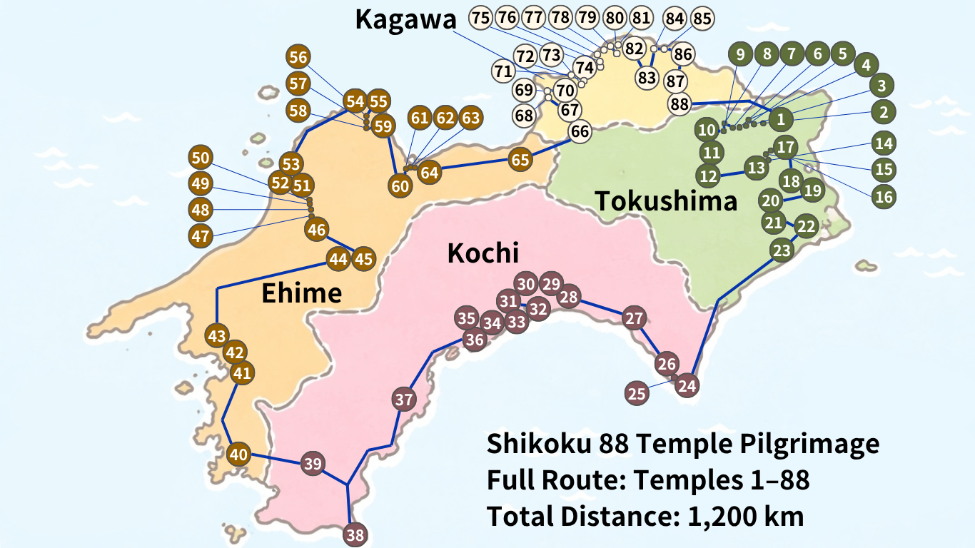
- Full Map of the Shikoku 88 Temple Pilgrimage
- Elevation Map of the Shikoku Pilgrimage
- Convenience Store “Food Gap” Heatmap of the Shikoku Pilgrimage
- Google Maps List for the Shikoku Pilgrimage
- Which Sections Are Actually the Toughest?
- Shikoku Pilgrimage Difficult Areas Based on Distance and Elevation
- When we organize the 88 pilgrimage segments by distance and elevation gain, they fall into three types:
- Standard Sections (approx. 77%) | The Core of the Route
- Mountain Sections (approx. 14%) | Short but Physically Demanding
- Long-Distance Sections (approx. 9%) | Distance Itself Is the Challenge
- Conclusion | Difficulty Is Defined by Either Hills or Distance
- Which is Better for the Shikoku Pilgrimage: Paper Maps or Smartphone Maps?
- Related Articles
What map should you use for the Shikoku Pilgrimage?
There is no single “perfect map” that will cover everything for the Shikoku Pilgrimage.
This is because the type of map you need changes depending on your purpose—for example, locating temples (sacred sites), checking walking routes, or finding supply points.
In particular, for walking pilgrims, not only distance but also elevation changes and the availability of convenience stores can significantly affect route planning. On the other hand, for those traveling by car, parking availability and travel time are more important factors.
For this reason, it is recommended to use multiple maps depending on your needs during the pilgrimage.
In this article, we provide:
- A full map showing the locations of all 88 temples of the Shikoku Pilgrimage
- An elevation (topography) map
- A heat map showing areas without convenience stores
- Google Maps links for each individual temple
Please note that clicking the map links will take you to the relevant sections within the article.
Maps Needed for Walking the Shikoku Pilgrimage
For walking pilgrims, what matters most is not just the location of each temple, but understanding “which sections are difficult” and “where you can resupply.”
Beginners often tend to focus only on the distances between temples. However, in reality, elevation gain and loss consume far more physical energy than distance alone.
For example, Temples 12 (Shosan-ji), 20 (Kakurin-ji), and 21 (Taiyu-ji) are well known for their steep ascents, which are far more demanding than the distance might suggest.
In addition, in mountainous and coastal areas, there are stretches where convenience stores are completely absent for long distances. If you do not check in advance where you can refill water or purchase food, it may lead to unexpected problems.
For walking the pilgrimage, it is recommended to prepare the following four types of maps:
- A full map of all 88 Shikoku Pilgrimage temples
- An elevation (topography) map
- A heat map showing convenience-store-free areas
- Google Maps
In particular, the elevation map and convenience store map are especially useful when planning each day’s itinerary.
Maps Needed for Driving the Shikoku Pilgrimage
For the Shikoku Pilgrimage by car, elevation is not as important as it is for walking pilgrims.
Instead, what matters most is efficiently understanding travel routes and driving times to each temple.
The 88 temples of the Shikoku Pilgrimage are spread across four prefectures—Tokushima, Kochi, Ehime, and Kagawa—and completing the full route involves a total driving distance of approximately 1,200 km.
For this reason, the following types of maps are especially useful for a car pilgrimage:
- A full map of all 88 Shikoku Pilgrimage temples
- Google Maps for each temple
- A car navigation system (GPS)
- A printed pilgrimage map (paper guidebook map)
Google Maps is particularly useful because it reflects up-to-date road conditions and provides detailed navigation guidance.
However, in mountainous areas, mobile reception can be unstable. Therefore, it is recommended to also carry a paper map or a printed pilgrimage guide for added safety.
Can You Complete the Pilgrimage Using Only a Smartphone?
The short answer is yes—today, it is possible to complete the Shikoku Pilgrimage using only a smartphone.
By using Google Maps, you can check your current location, search routes, estimate travel time, and navigate directly to each temple.
In addition, you can also search for accommodation, restaurants, and convenience stores all on a single device.
However, for walking pilgrims, there are several important limitations to be aware of:
- Battery drain
- Weak mobile signal in mountainous areas
- Risk of device failure in rain or harsh weather
- GPS inaccuracies
In particular, around Mount Shosan-ji and other mountainous sections, map loading may become slow or unstable due to poor connectivity.
For this reason, even if you rely mainly on a smartphone, it is important to download maps in advance and carry a mobile battery.
Also, if you check elevation maps and convenience-store-absence heatmaps beforehand (as introduced in this article), you can plan your journey more smoothly without confusion on site.
In recent years, more pilgrims have been completing the full journey using only smartphones. However, from a safety perspective, the most reliable approach is still a combination of Google Maps and pre-checked pilgrimage maps.
Full Map of the Shikoku 88 Temple Pilgrimage
The Shikoku 88 Temple Pilgrimage is a pilgrimage route that visits 88 sacred temples scattered across the four prefectures of Shikoku.
When all the temples are connected, the total distance is approximately 1,200 km, and it is not uncommon for a walking pilgrimage to take more than 40 days to complete.
For this reason, one of the first things you should check before starting the pilgrimage is a “full map of the Shikoku 88 temples.”
By looking at the overall map, you can understand:
- Where the temples are concentrated
- How far it is to the next prefecture
- Which areas contain difficult or demanding sections
For first-time pilgrims, it is important to understand the overall layout of Shikoku before focusing on detailed maps of individual temples.
Map Showing the Locations of the Shikoku 88 Temples at a Glance

The Shikoku 88 Temple Pilgrimage generally begins in Tokushima Prefecture and proceeds clockwise through Kochi, Ehime, and finally Kagawa Prefecture.
When you look at the overall map, you can see that the temples are not evenly distributed across Shikoku, and the density varies significantly by region.
In particular, Tokushima has 23 temples concentrated in one area, making it a common starting point for many pilgrims.
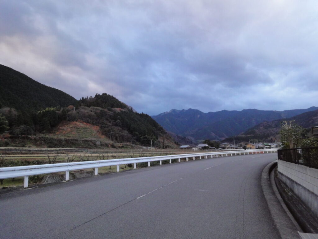
On the other hand, Kochi is known for having long distances between temples and is often referred to as the “training dojo” due to its physically demanding travel sections.
By checking the full map in advance, you can plan your pilgrimage route more effectively.
Distribution of the Shikoku 88 Temples by Prefecture (Tokushima, Kochi, Ehime, Kagawa)
The Shikoku 88 Temple Pilgrimage has distinct characteristics depending on the prefecture.
Tokushima Prefecture (Temples 1–23)
Tokushima is known as the “Land of Awakening” (Hossin no Dojo) and serves as the starting point of the pilgrimage.
It contains 23 temples, and compared to the other prefectures, they are relatively concentrated within a smaller area.
However, despite this density, there are also mountainous sections, including Mount Shosan-ji (Temple 12), which is one of the first major challenges for walking pilgrims.
Kochi Prefecture (Temples 24–39)
Kochi Prefecture is known as the “Training Dojo” (Shugyo no Dojo).
It has 16 temples, but the defining feature is that the distance between each temple is very long.
In areas such as Cape Muroto and Cape Ashizuri, pilgrims must walk long stretches of road, making not only physical endurance but also careful planning for food and water supplies extremely important.
Ehime Prefecture (Temples 40–65)
Ehime Prefecture is known as the “Dojo of Enlightenment” (Bodai no Dojo).
It has 26 temples, the largest number among the four prefectures in Shikoku.
Sections around Temple 44 (Daiho-ji) and Temple 60 (Yokomine-ji) are particularly demanding, as they combine long distances with significant elevation changes, making them some of the most challenging stretches of the pilgrimage.
Kagawa Prefecture (Temples 66–88)
Kagawa Prefecture is known as the “Dojo of Nirvana” (Nehan no Dojo).
It is the final stage of the pilgrimage, where pilgrims aim to complete their journey, and it contains 23 temples.
Compared to other prefectures, the distances are relatively shorter and easier to travel, allowing pilgrims to progress through the final stages of the route while experiencing a growing sense of accomplishment toward completion.
In What Order Should You Visit the Temples?
There are no strict rules for the order in which you must visit the 88 temples of the Shikoku Pilgrimage. However, most pilgrims follow the traditional “clockwise route” starting from Temple 1 and proceeding to Temple 88, known as “Jun-uchi” (forward pilgrimage).
Junuchi is recommended for beginners because the route is easy to understand, and there is plenty of information available on accommodation and transportation along the way.
On the other hand, there is also a method called “Gyaku-uchi” (reverse pilgrimage), where pilgrims travel from Temple 88 back toward Temple 1.
Reverse pilgrimage is considered more difficult, but there is also a traditional belief that it brings greater spiritual merit if completed during a leap year.
In recent years, an increasing number of people also choose “Kugiri-uchi”, which means completing the pilgrimage in separate segments over multiple trips due to time constraints.
By checking the overall map of temple locations in advance, you can plan efficiently regardless of which style you choose:
- Forward pilgrimage (Jun-uchi)
- Reverse pilgrimage (Gyaku-uchi)
- Segment-based pilgrimage (Kugiri-uchi)
The best first step is to understand the overall layout of Shikoku on a full map, and then decide which pilgrimage style best suits your schedule and goals.
Elevation Map of the Shikoku Pilgrimage
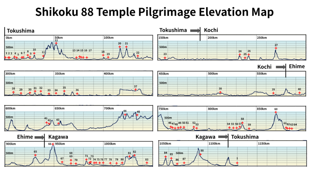
For walking pilgrims, elevation change is just as important as distance when planning the route to each temple.
Even if two sections are both 20 km, the physical strain is completely different between flat roads and steep mountain trails.
Many of the 88 temples are located in mountainous areas, so checking elevation changes in advance allows pilgrims to plan a realistic and sustainable journey.
The elevation map in this article lets you easily see where major climbs occur along the route at a glance.
Why You Should Check Elevation Changes for Walking the Pilgrimage
One of the most common mistakes made by beginners in the walking pilgrimage is planning their itinerary based only on distance.
For example, a 20 km flat section can be relatively manageable, but a 20 km route that includes mountainous terrain requires an entirely different level of physical effort.
In fact, what causes the most fatigue during the pilgrimage is not long-distance walking itself, but steep ascents and descents.
By checking elevation changes in advance, you can take measures such as:
- Starting earlier in the day
- Changing your planned accommodation
- Carrying more food and water supplies
- Increasing rest time
In particular, during the summer season, uphill sections can quickly drain your energy, making elevation maps an essential tool for planning a safe and realistic pilgrimage schedule.
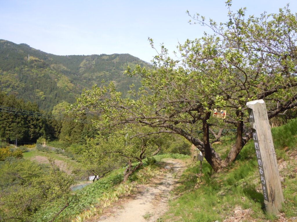
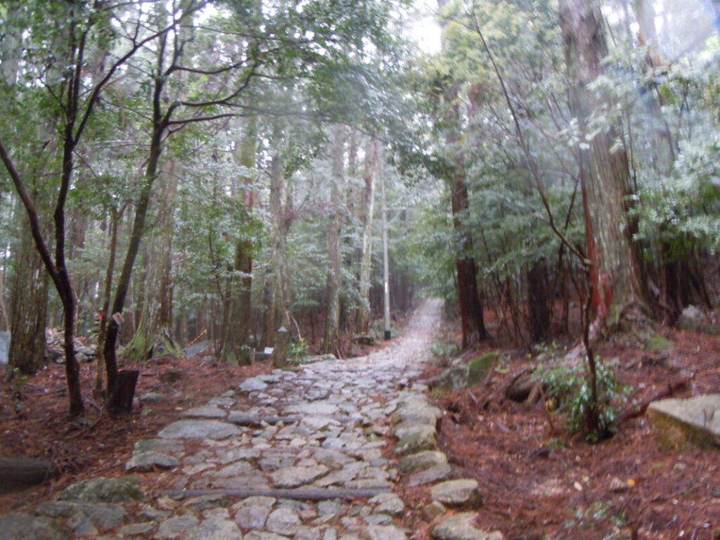
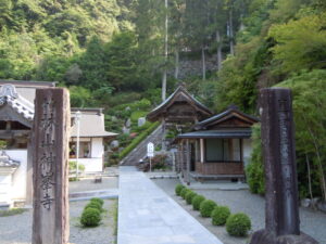
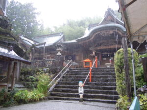
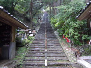
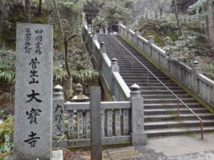
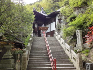
The Biggest Challenge: Shosan-ji (Temple 12)
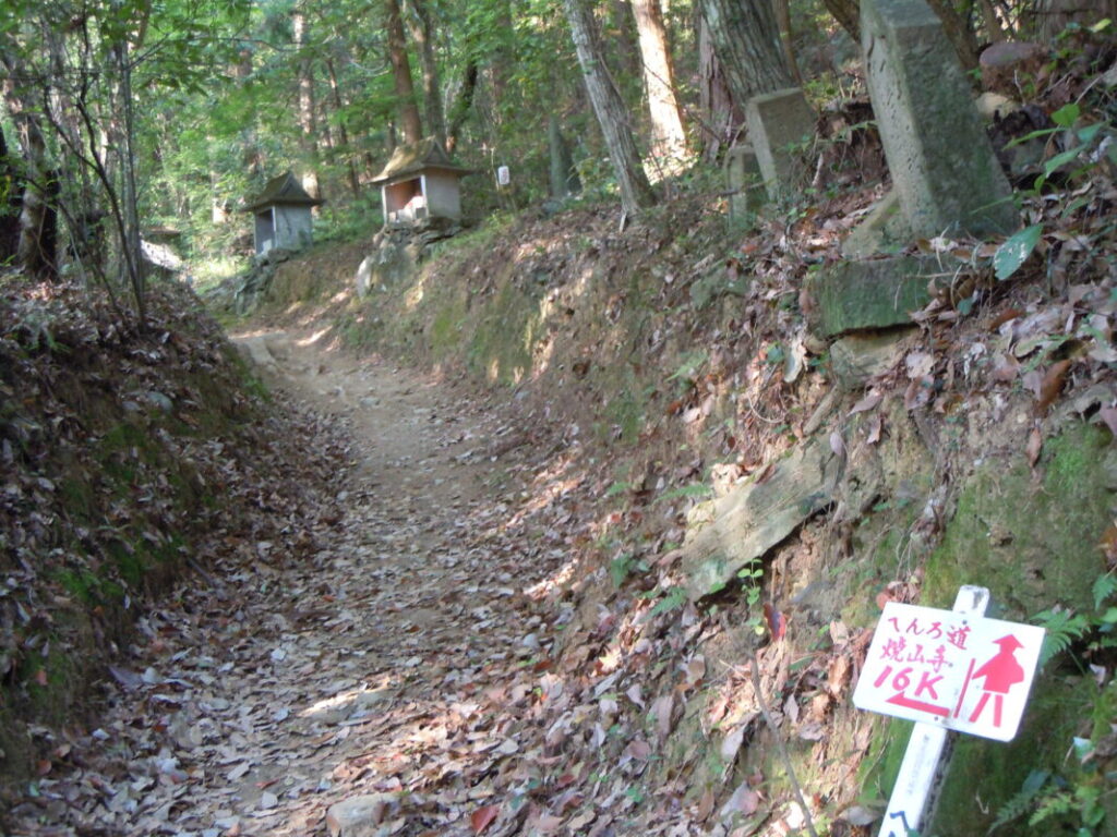
Temple 12, Shosan-ji, is widely known as one of the most difficult sections of the entire Shikoku Pilgrimage.
Located at an elevation of around 700 meters, it is the first serious mountain section that many walking pilgrims encounter.
The pilgrimage trail from Temple 11 (Fujii-dera) to Shosan-ji involves a long and continuous ascent, which is far more exhausting than the distance alone would suggest.
Among experienced pilgrims, it is often said:
“Once you pass Shosan-ji, the hardest part is over.”
During the summer season in particular, proper hydration is essential, so it is important to secure enough drinking water before starting the climb.
For first-time pilgrims, it is crucial to plan a generous schedule that allows enough time and energy to complete this section without rushing.
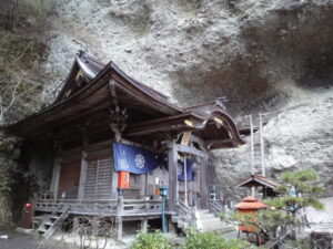
Elevation Challenges at Kakurin-ji, Tairyu-ji, and Yokomine-ji
In addition to Shosan-ji, there are several other mountain temples that require special attention during the walking pilgrimage.
Temple 20: Kakurin-ji
Kakurin-ji is known as one of the “henro korogashi” (extremely difficult climbing sections).
Located near the mountain summit, the route to the temple involves a long and steep ascent.
It places significant strain not only on stamina but also on the legs, making pace control extremely important.
Temple 21: Tairyu-ji
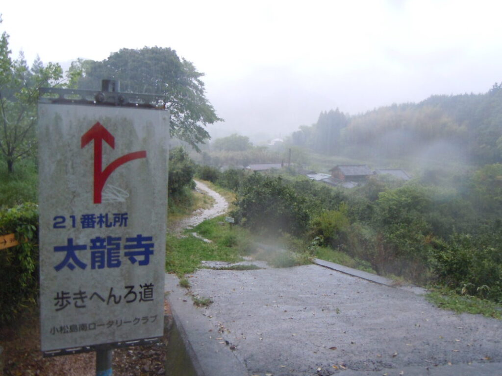
Tairyu-ji is another well-known difficult mountain temple alongside Kakurin-ji.
The walking route involves continuous mountain crossings, requiring careful energy management throughout both the approach and departure sections.
It is considered one of the most challenging areas within Tokushima Prefecture.
Temple 60: Yokomine-ji
Yokomine-ji in Ehime Prefecture is known as one of the toughest climbs in the latter half of the pilgrimage.
By this stage, pilgrims have already covered a long distance, so the accumulated fatigue makes the ascent even more demanding.
Although it is close to the final goal of the pilgrimage, it remains a serious and unavoidable challenge.
Difficulty Levels Based on Elevation Changes
Looking at elevation maps reveals that the difficulty of the Shikoku 88 Temple Pilgrimage is not uniform.
The walking pilgrimage can be roughly categorized as follows:
Beginner Level
- Flat areas in Tokushima Plain
- Urban areas around Ehime City
- Some sections of Kagawa Prefecture
These routes are relatively flat and easy to walk, making them suitable for beginners.
Intermediate Level
- Eastern Kochi Prefecture
- Central Ehime Prefecture
- Mountainous areas of Kagawa Prefecture
These sections include more frequent ups and downs, leading to greater physical strain.
Advanced Level
- Areas around Shosan-ji
- Kakurin-ji and Tairyu-ji regions
- Yokomine-ji area
These sections include steep mountain climbs known as “henro korogashi,” making them some of the most demanding parts of the pilgrimage.
In particular, Shosan-ji is widely regarded as one of the toughest challenges in the entire walking pilgrimage, and many pilgrims struggle with this section.
When planning the pilgrimage, it is important to consider not only distance but also elevation changes.
By using elevation maps, you can determine where to conserve energy and where to allow more time in your schedule.
To ensure a safe and enjoyable walking pilgrimage, it is essential to check elevation conditions before starting your journey.
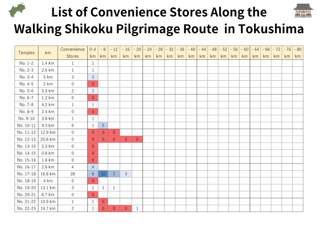
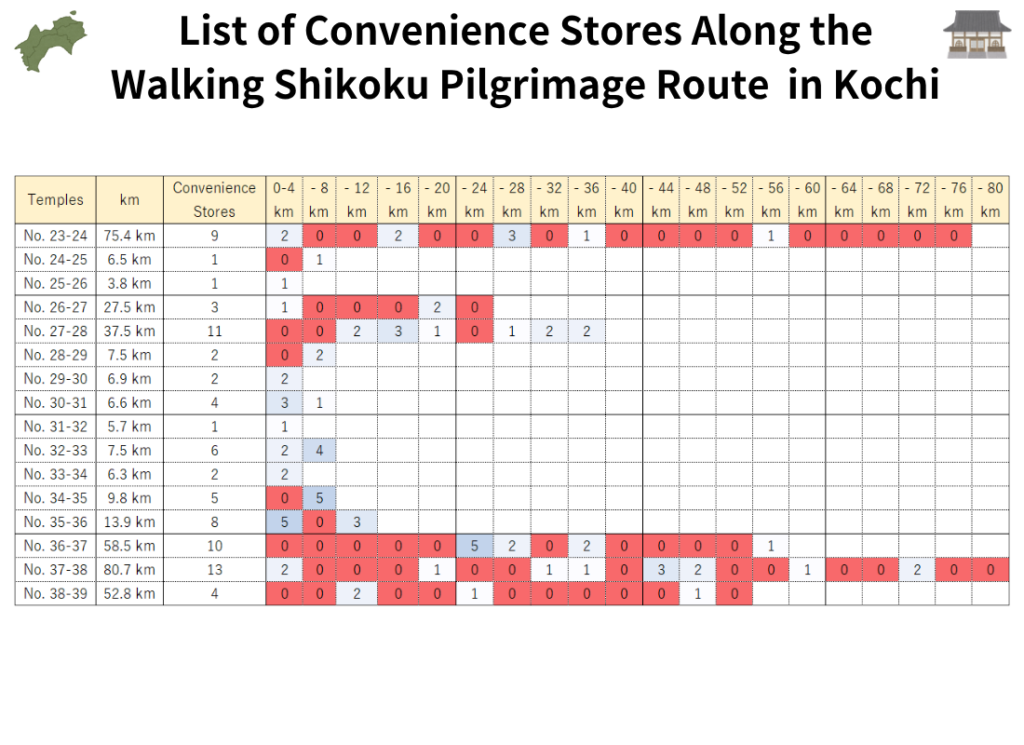
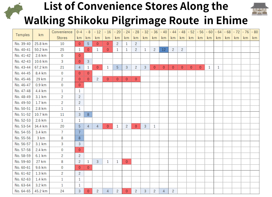
Convenience Store “Food Gap” Heatmap of the Shikoku Pilgrimage
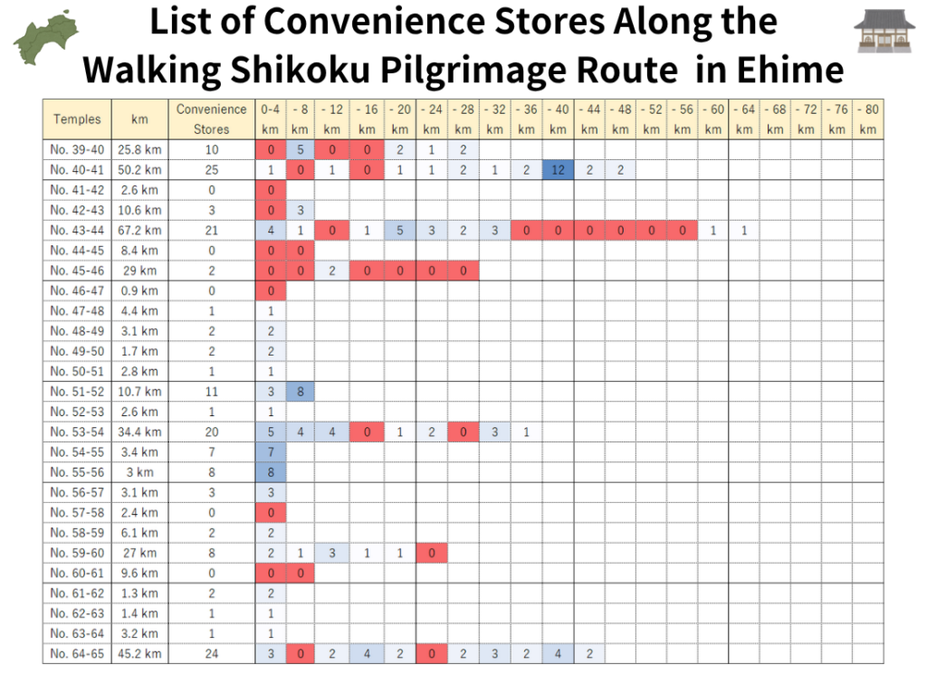
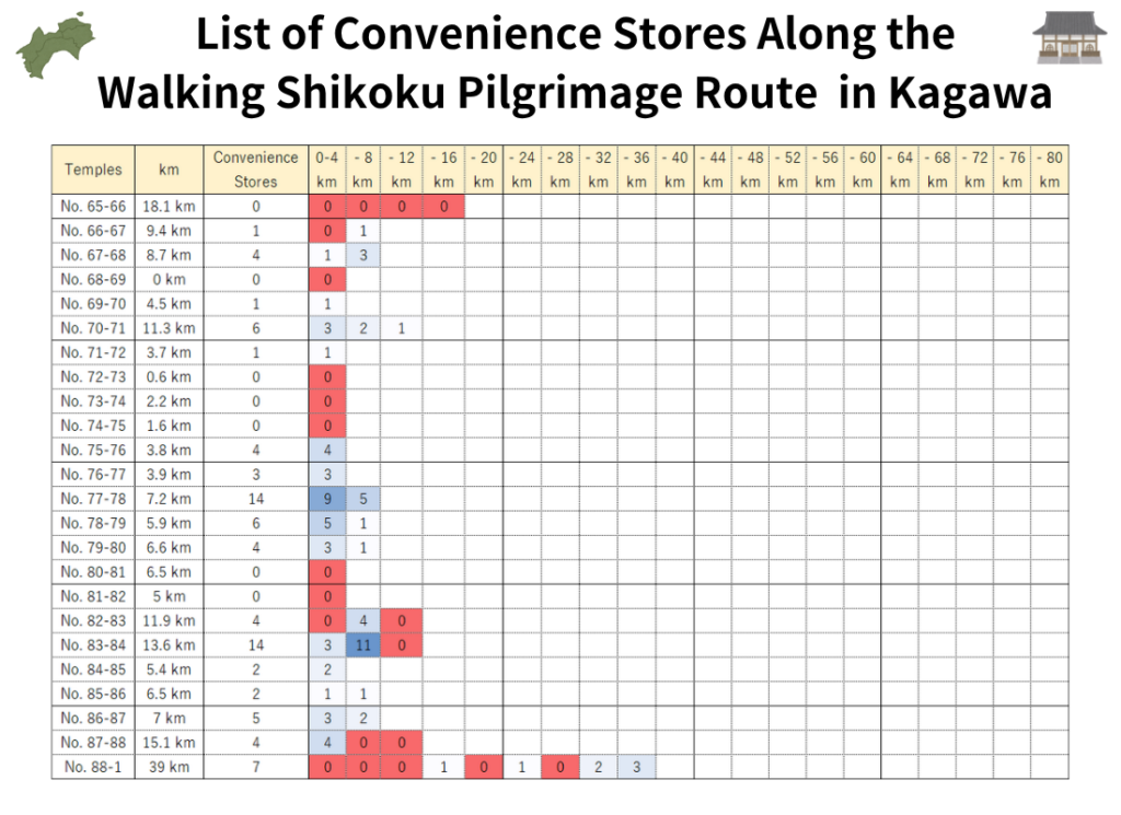
For walking pilgrims, just as important as the location of each temple is the availability of supply points along the route.
In particular, convenience stores—where pilgrims can easily restock drinking water and food—are essential facilities during long-distance walking.
However, along the route of the Shikoku 88 Temple Pilgrimage, there are many mountainous and coastal sections far from urban areas, where convenience stores may be absent for long stretches.
For this reason, this article analyzes convenience store distribution along the pilgrimage route and presents a “convenience store gap heatmap.”
By using this heatmap, you can easily identify:
- Sections where supplies are easy to obtain
- Areas with few or no convenience stores
- Regions where advance preparation is necessary
This allows pilgrims to better understand where to restock and plan their journey more safely and efficiently.
Ranking of Sections with Few Convenience Stores on the Shikoku Pilgrimage Route
Survey results show that there are several sections along the pilgrimage route where convenience stores are extremely scarce.
1st Place: Shosan-ji Area (Temple No. 12)
Located in a mountainous region, this area has very limited opportunities for resupply.
For walking pilgrims, it is essential to prepare sufficient water and portable food before starting the ascent.
2nd Place: Cape Ashizuri Area (Temple No. 38)
This region has long distances between temples and very few urban areas.
It is not uncommon for pilgrims to walk for several hours without encountering a single convenience store.
3rd Place: Cape Muroto Area (Temple No. 24)
This section involves long stretches along the coastline.
Depending on the route, resupply points are limited, so caution is required.
4th Place: Western Kochi Coastal Areas (Temple No. 37)
There are few residential zones, and shops are scattered.
Advance planning for food and water supply is essential.
5th Place: Yokomine-ji Area (Temple No. 60)
As a mountainous section, there are no reliable supply points near the temple itself.
Preparation before the climb is absolutely necessary in this area.
Supply Conditions Around Shosan-ji (Temple 12)
Temple 12, Shosan-ji, is the first major challenge many walking pilgrims encounter on the Shikoku Pilgrimage.
The difficulty is not only the elevation gain.
Because the surrounding area is mountainous, there are very few convenience stores or supermarkets, making it difficult to resupply essential items along the way.
In particular, dehydration becomes a serious concern during the summer months.
Before heading toward Shosan-ji, it is important to prepare enough of the following:
- Drinking water
- Sports drinks
- Portable food (trail snacks)
- Mobile battery pack
Relying on the assumption that “there will be a store ahead” can be risky, as there may be unexpectedly long stretches without any opportunity to restock supplies.
Supply Conditions Around Cape Muroto
The area around Cape Muroto, heading toward Temple 24 (Muroto-zaki / Hotsumisaki-ji), is a popular section of the pilgrimage route featuring the dramatic coastal scenery typical of Kochi Prefecture.
At the same time, it is also an area with limited supply points due to the scarcity of urban settlements.
Because pilgrims walk long stretches along the coastline, it is recommended to prepare the following in advance:
- Water
- Light meals / snacks
- Sun protection items (hat, sunscreen, etc.)
In particular, during summer, the lack of shade can lead to significant fatigue.
Whenever you do come across a convenience store, it is wise to purchase what you need early rather than waiting for the next opportunity.
This section of the Shikoku 88 Temple Pilgrimage, especially around Cape Muroto, is known for requiring careful self-sufficiency despite its beautiful scenery.
Supply Conditions Around Cape Ashizuri
The Cape Ashizuri area is one of the regions where many walking pilgrims strongly feel the difficulty of resupply during the Shikoku Pilgrimage.
Temple distances are long, and the route includes both coastal and mountainous sections.
Unlike urban areas, there are no convenience stores every few kilometers, making it easy for issues such as the following to occur:
- Running out of drinking water
- Running out of food or snacks
- Mobile battery depletion
For first-time pilgrims in particular, it is important not to plan solely based on distance shown on a map, but also to carefully consider where supplies can be obtained when planning the itinerary.
This is especially true in remote sections of the Cape Ashizuri along the Shikoku 88 Temple Pilgrimage route, where self-sufficiency is essential for safe travel.
Key Points to Avoid Resupply Mistakes on the Walking Pilgrimage
During the walking pilgrimage, many pilgrims struggle not because of physical ability, but because of insufficient supplies.
To safely walk through convenience store “food gap” areas, keep the following points in mind:
Always resupply when you find a convenience store
Even if you still feel you have enough supplies, the next store may be several hours away.
It is best to restock water and snacks early whenever you have the chance.
Carry more water in summer
Hot weather significantly increases sweating.
Mountain sections in particular can lead to much higher water consumption than expected, so always carry extra.
Keep portable food on hand
There are sections where even simple foods like rice balls or bread are not available.
Bringing portable snacks such as energy bars or nuts is highly recommended.
Never forget a mobile battery
Smartphones are essential for navigation, accommodation booking, and information gathering.
A dead battery can become a serious problem, so carrying a backup power source is important.
By using a “convenience store gap heatmap,” you can easily understand where to resupply and where caution is needed.
To walk the pilgrimage safely and comfortably, it is essential to plan not only around temples but also around supply points.
Google Maps List for the Shikoku Pilgrimage
In recent years, with the widespread use of smartphones, more pilgrims have begun using Google Maps during the Shikoku Pilgrimage.
In the past, printed pilgrimage guide maps were essential, but today Google Maps makes it easy to check your current location and search routes in real time.
It is especially helpful for first-time pilgrims, as it allows them to understand the locations of temples and plan travel routes more easily.
Here, the temples of the Shikoku 88 Temple Pilgrimage are organized by prefecture. Each temple’s detail page also includes photos and links to Google Maps, which can be used for pilgrimage planning.
Benefits of Using Google Maps for the Shikoku Pilgrimage
One of the biggest advantages of Google Maps is that it allows you to instantly check the route from your current location to each temple.
It can be used not only for walking pilgrims, but also for those traveling by car or bicycle.
The main benefits of using Google Maps include:
- Checking your current location
- Searching routes to temples
- Estimating travel time
- Finding convenience stores and restaurants
- Searching for accommodation
- Free to use
In particular, for walking pilgrims, being able to search for lodging and supply points on a single smartphone is a major advantage.
However, in mountainous areas, mobile reception can be unstable, so it is safer to check and download routes in advance whenever possible.
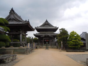
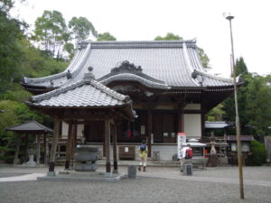
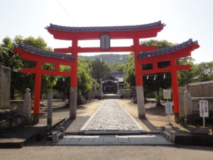
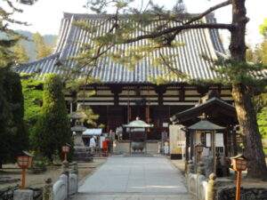
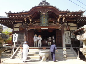
Temples 1–23 (Tokushima Prefecture)
Tokushima Prefecture is known as the “Land of Awakening” (Hossin no Dojo) and serves as the starting point of the Shikoku Pilgrimage.
It includes 23 temples, from Temple 1 (Ryozen-ji) to Temple 23 (Yakuo-ji), forming the foundational section of the entire Shikoku 88 Temple Pilgrimage.
In particular, the route from Temple 11 (Fujii-dera) to Temple 12 (Shosan-ji) is known as the first major challenge for walking pilgrims.
On each temple page below, you will find:
- Temple photos
- Google Maps links
- Access information
- Distances between temples
This section provides essential information for planning the early stages of the pilgrimage.
Temple 1: Ryozenji
| ◀ Prev Temple | Next Temple ▶ |
| – | 1.4 km |
| Google Maps | MAP |
| Transport | – |
| Accommodation | Places to Stay |
Temple 2: Gokurakuji
| ◀ Prev Temple | Next Temple ▶ |
| 1.4 km | 2.6 km |
| Google Maps | MAP |
| Transport | – |
| Accommodation | Places to Stay |
Temple 3: Konsenji
| ◀ Prev Temple | Next Temple ▶ |
| 2.6 km | 5 km |
| Google Maps | MAP |
| Transport | – |
| Accommodation | Places to Stay |
Temple 4: Dainichiji
| ◀ Prev Temple | Next Temple ▶ |
| 5 km | 2 km |
| Google Maps | MAP |
| Transport | – |
| Accommodation | Places to Stay |
Temple 5: Jizoji
| ◀ Prev Temple | Next Temple ▶ |
| 2 km | 5.3 km |
| Google Maps | MAP |
| Transport | – |
| Accommodation | Places to Stay |
Temple 6: Anrakuji
| ◀ Prev Temple | Next Temple ▶ |
| 5.3 km | 1.2 km |
| Google Maps | MAP |
| Transport | – |
| Accommodation | Places to Stay |
Temple 7: Jurakuji
| ◀ Prev Temple | Next Temple ▶ |
| 1.2 km | 4.2 km |
| Google Maps | MAP |
| Transport | – |
| Accommodation | Places to Stay |
Temple 8: Kumadaniji
| ◀ Prev Temple | Next Temple ▶ |
| 4.2 km | 2.4 km |
| Google Maps | MAP |
| Transport | – |
| Accommodation | Places to Stay |
Temple 9: Horinji
| ◀ Prev Temple | Next Temple ▶ |
| 2.4 km | 3.8 km |
| Google Maps | MAP |
| Transport | – |
| Accommodation | Places to Stay |
Temple 10: Kirihataji
| ◀ Prev Temple | Next Temple ▶ |
| 3.8 km | 9.3 km |
| Google Maps | MAP |
| Transport | – |
| Accommodation | Places to Stay |
Temple 11: Fujiidera
| ◀ Prev Temple | Next Temple ▶ |
| 9.3 km | 12.9 km |
| Google Maps | MAP |
| Transport | – |
| Accommodation | Places to Stay |
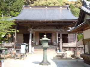
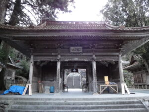
Temple 12: Shosanji
| ◀ Prev Temple | Next Temple ▶ |
| 12.9 km | 20.8 km |
| Google Maps | MAP |
| Transport | – |
| Accommodation | Places to Stay |
Temple 13: Dainichiji
| ◀ Prev Temple | Next Temple ▶ |
| 20.8 km | 2.3 km |
| Google Maps | MAP |
| Transport | – |
| Accommodation | Places to Stay |
Temple 14: Jorakuji
| ◀ Prev Temple | Next Temple ▶ |
| 2.3 km | 0.8 km |
| Google Maps | MAP |
| Transport | – |
| Accommodation | Places to Stay |
Temple 15: Kokubunji
| ◀ Prev Temple | Next Temple ▶ |
| 0.8 km | 1.8 km |
| Google Maps | MAP |
| Transport | – |
| Accommodation | Places to Stay |
Temple 16: Kannonji
| ◀ Prev Temple | Next Temple ▶ |
| 1.8 km | 2.8 km |
| Google Maps | MAP |
| Transport | – |
| Accommodation | Places to Stay |
Temple 17: Idoji
| ◀ Prev Temple | Next Temple ▶ |
| 2.8 km | 16.8 km |
| Google Maps | MAP |
| Transport | – |
| Accommodation | Places to Stay |
Temple 18: Onzanji
| ◀ Prev Temple | Next Temple ▶ |
| 16.8 km | 4 km |
| Google Maps | MAP |
| Transport | – |
| Accommodation | Places to Stay |
Temple 19: Tatsueji
| ◀ Prev Temple | Next Temple ▶ |
| 4 km | 13.1 km |
| Google Maps | MAP |
| Transport | – |
| Accommodation | Places to Stay |
Temple 20: Kakurinji
| ◀ Prev Temple | Next Temple ▶ |
| 13.1 km | 6.7 km |
| Google Maps | MAP |
| Transport | – |
| Accommodation | Places to Stay |
Temple 21: Tairyuji
| ◀ Prev Temple | Next Temple ▶ |
| 6.7 km | 10.9 km |
| Google Maps | MAP |
| Transport | – |
| Accommodation | Places to Stay |
Temple 22: Byodoji
| ◀ Prev Temple | Next Temple ▶ |
| 10.9 km | 19.7 km |
| Google Maps | MAP |
| Transport | – |
| Accommodation | Places to Stay |
Temple 23: Yakuoji
| ◀ Prev Temple | Next Temple ▶ |
| 19.7 km | 75.4 km |
| Google Maps | MAP |
| Transport | Check Timetable |
| Accommodation | Places to Stay |
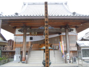
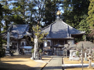
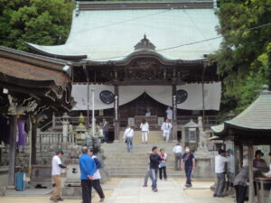
Temples 24–39 (Kochi Prefecture)
Kochi Prefecture is known as the “Training Dojo” (Shugyo no Dojo) of the Shikoku Pilgrimage.
It includes 16 temples, from Temple 24 (Muroto-zaki / Hotsumisaki-ji) to Temple 39 (Enko-ji), and is also known for its long distances between temples.
This region offers some of the most scenic coastal routes in Shikoku, including Cape Muroto and Cape Ashizuri. At the same time, it is also an area where careful supply planning is essential.
By using Google Maps, you can check in advance:
- Accommodation
- Convenience stores
- Restaurants
This helps ensure safer and more efficient planning while walking through this demanding section of the pilgrimage.
Temple 24: Hotsumisakiji
| ◀ Prev Temple | Next Temple ▶ |
| 75.4 km | 6.5 km |
| Google Maps | MAP |
| Transport | Check Timetable |
| Accommodation | Places to Stay |
Temple 25: Shinshoji
| ◀ Prev Temple | Next Temple ▶ |
| 6.5 km | 3.5 km |
| Google Maps | MAP |
| Transport | Check Timetable |
| Accommodation | Places to Stay |
Temple 26: Kongochōji
| ◀ Prev Temple | Next Temple ▶ |
| 3.5 km | 27.5 km |
| Google Maps | MAP |
| Transport | Check Timetable |
| Accommodation | Places to Stay |
Temple 27: Konomineji
| ◀ Prev Temple | Next Temple ▶ |
| 27.5 km | 37.5 km |
| Google Maps | MAP |
| Transport | Check Timetable |
| Accommodation | Places to Stay |
Temple 28: Dainichiji
| ◀ Prev Temple | Next Temple ▶ |
| 37.5 km | 7.5 km |
| Google Maps | MAP |
| Transport | Check Timetable |
| Accommodation | Places to Stay |
Temple 29: Kokubunji
| ◀ Prev Temple | Next Temple ▶ |
| 7.5 km | 6.9 km |
| Google Maps | MAP |
| Transport | – |
| Accommodation | Places to Stay |
Temple 30: Zenrakuji
| ◀ Prev Temple | Next Temple ▶ |
| 6.9 km | 6.6 km |
| Google Maps | MAP |
| Transport | – |
| Accommodation | Places to Stay |
Temple 31: Chikurinji
| ◀ Prev Temple | Next Temple ▶ |
| 6.6 km | 5.7 km |
| Google Maps | MAP |
| Transport | – |
| Accommodation | Places to Stay |
Temple 32: Zenjibuji
| ◀ Prev Temple | Next Temple ▶ |
| 5.7 km | 7.5 km |
| Google Maps | MAP |
| Transport | – |
| Accommodation | Places to Stay |
Temple 33: Sekkeiji
| ◀ Prev Temple | Next Temple ▶ |
| 7.5 km | 6.3 km |
| Google Maps | MAP |
| Transport | – |
| Accommodation | Places to Stay |
Temple 34: Tanemaji
| ◀ Prev Temple | Next Temple ▶ |
| 6.3 km | 9.8 km |
| Google Maps | MAP |
| Transport | – |
| Accommodation | Places to Stay |
Temple 35: Kiyotakiji
| ◀ Prev Temple | Next Temple ▶ |
| 9.8 km | 13.9 km |
| Google Maps | MAP |
| Transport | – |
| Accommodation | Places to Stay |
Temple 36: Shoryuji
| ◀ Prev Temple | Next Temple ▶ |
| 13.9 km | 58.5 km |
| Google Maps | MAP |
| Transport | – |
| Accommodation | Places to Stay |
Temple 37: Iwamotoji
| ◀ Prev Temple | Next Temple ▶ |
| 58.5 km | 80.7 km |
| Google Maps | MAP |
| Transport | – |
| Accommodation | Places to Stay |
Temple 38: Kongofukuji
| ◀ Prev Temple | Next Temple ▶ |
| 80.7 km | 52.8 km |
| Google Maps | MAP |
| Transport | Check Timetable |
| Accommodation | Places to Stay |
Temple 39: Enkoji
| ◀ Prev Temple | Next Temple ▶ |
| 52.8 km | 25.8 km |
| Google Maps | MAP |
| Transport | Check Timetable |
| Accommodation | Places to Stay |
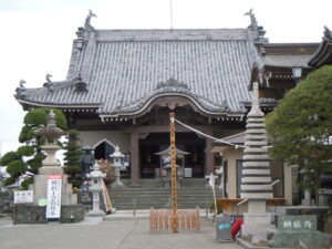
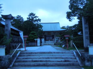
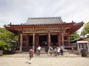
Temples 40–65 (Ehime Prefecture)
Ehime Prefecture is known as the “Dojo of Enlightenment” (Bodai no Dojo) in the Shikoku Pilgrimage.
It includes 26 temples, from Temple 40 (Kanjizai-ji) to Temple 65 (Sankaku-ji), and has the highest concentration of temples among the four prefectures of Shikoku.
Many of the temples are located near urban areas, where accommodation and commercial facilities are relatively well developed.
On the other hand, Temple 60 (Yokomine-ji) is known as a mountainous temple and requires extra caution for walking pilgrims.
By using Google Maps, it is easy to check facilities around each temple in advance, helping with more efficient and practical planning.
Temple 40: Kanjizaiji
| ◀ Prev Temple | Next Temple ▶ |
| 25.8 km | 50.2 km |
| Google Maps | MAP |
| Transport | – |
| Accommodation | Places to Stay |
Temple 41: Ryukoji
| ◀ Prev Temple | Next Temple ▶ |
| 50.2 km | 2.6 km |
| Google Maps | MAP |
| Transport | – |
| Accommodation | Places to Stay |
Temple 42: Butsumokuji
| ◀ Prev Temple | Next Temple ▶ |
| 2.6 km | 10.6 km |
| Google Maps | MAP |
| Transport | – |
| Accommodation | Places to Stay |
Temple 43: Meisekiji
| ◀ Prev Temple | Next Temple ▶ |
| 10.6 km | 67.2 km |
| Google Maps | MAP |
| Transport | – |
| Accommodation | Places to Stay |
Temple 44: Daihoji
| ◀ Prev Temple | Next Temple ▶ |
| 67.2 km | 8.4 km |
| Google Maps | MAP |
| Transport | Check Timetable |
| Accommodation | Places to Stay |
Temple 45: Iwayaji
| ◀ Prev Temple | Next Temple ▶ |
| 8.4 km | 29 km |
| Google Maps | MAP |
| Transport | – |
| Accommodation | Places to Stay |
Temple 46: Joruriji
| ◀ Prev Temple | Next Temple ▶ |
| 29 km | 0.9 km |
| Google Maps | MAP |
| Transport | – |
| Accommodation | Places to Stay |
Temple 47: Yasakaji
| ◀ Prev Temple | Next Temple ▶ |
| 0.9 km | 4.4 km |
| Google Maps | MAP |
| Transport | – |
| Accommodation | Places to Stay |
Temple 48: Sairinji
| ◀ Prev Temple | Next Temple ▶ |
| 4.4 km | 3.1 km |
| Google Maps | MAP |
| Transport | – |
| Accommodation | Places to Stay |
Temple 49: Jodoji
| ◀ Prev Temple | Next Temple ▶ |
| 3.1 km | 1.7 km |
| Google Maps | MAP |
| Transport | – |
| Accommodation | Places to Stay |
Temple 50: Hantaji
| ◀ Prev Temple | Next Temple ▶ |
| 1.7 km | 2.8 km |
| Google Maps | MAP |
| Transport | – |
| Accommodation | Places to Stay |
Temple 51: Ishiteji
| ◀ Prev Temple | Next Temple ▶ |
| 2.8 km | 10.7 km |
| Google Maps | MAP |
| Transport | – |
| Accommodation | Places to Stay |
Temple 52: Taisanji
| ◀ Prev Temple | Next Temple ▶ |
| 10.7 km | 2.6 km |
| Google Maps | MAP |
| Transport | – |
| Accommodation | Places to Stay |
Temple 53: Enmyoji
| ◀ Prev Temple | Next Temple ▶ |
| 2.6 km | 34.4 km |
| Google Maps | MAP |
| Transport | – |
| Accommodation | Places to Stay |
Temple 54: Enmeiji
| ◀ Prev Temple | Next Temple ▶ |
| 34.4 km | 3.4 km |
| Google Maps | MAP |
| Transport | – |
| Accommodation | Places to Stay |
Temple 55: Nankobo
| ◀ Prev Temple | Next Temple ▶ |
| 3.4 km | 3 km |
| Google Maps | MAP |
| Transport | – |
| Accommodation | Places to Stay |
Temple 56: Taisanji
| ◀ Prev Temple | Next Temple ▶ |
| 3 km | 3.1 km |
| Google Maps | MAP |
| Transport | – |
| Accommodation | Places to Stay |
Temple 57: Eifukuji
| ◀ Prev Temple | Next Temple ▶ |
| 3.1 km | 2.4 km |
| Google Maps | MAP |
| Transport | – |
| Accommodation | Places to Stay |
Temple 58: Senyuji
| ◀ Prev Temple | Next Temple ▶ |
| 2.4 km | 6.1 km |
| Google Maps | MAP |
| Transport | – |
| Accommodation | Places to Stay |
Temple 59: Kokubunji
| ◀ Prev Temple | Next Temple ▶ |
| 6.1 km | 27 km |
| Google Maps | MAP |
| Transport | – |
| Accommodation | Places to Stay |
Temple 60: Yokomineji
| ◀ Prev Temple | Next Temple ▶ |
| 27 km | 9.6 km |
| Google Maps | MAP |
| Transport | – |
| Accommodation | Places to Stay |
Temple 61: Koenji
| ◀ Prev Temple | Next Temple ▶ |
| 9.6 km | 1.3 km |
| Google Maps | MAP |
| Transport | – |
| Accommodation | Places to Stay |
Temple 62: Hojyuji
| ◀ Prev Temple | Next Temple ▶ |
| 1.3 km | 1.4 km |
| Google Maps | MAP |
| Transport | – |
| Accommodation | Places to Stay |
Temple 63: Kichijoji
| ◀ Prev Temple | Next Temple ▶ |
| 1.4 km | 3.2 km |
| Google Maps | MAP |
| Transport | – |
| Accommodation | Places to Stay |
Temple 64: Maegamiji
| ◀ Prev Temple | Next Temple ▶ |
| 3.2 km | 45.2 km |
| Google Maps | MAP |
| Transport | – |
| Accommodation | Places to Stay |
Temple 65: Sankakuji
| ◀ Prev Temple | Next Temple ▶ |
| 45.2 km | 18.1 km |
| Google Maps | MAP |
| Transport | – |
| Accommodation | Places to Stay |
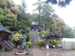
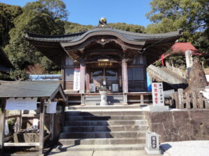
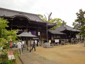
Temples 66–88 (Kagawa Prefecture)
Kagawa Prefecture is known as the “Dojo of Nirvana” (Nehan no Dojo) and is the final stage of the Shikoku Pilgrimage, where pilgrims aim to complete their journey.
It includes 23 temples, from Temple 66 (Unpen-ji) to Temple 88 (Okuboji), and is a section where many pilgrims experience a strong sense of accomplishment as they approach the end of the pilgrimage.
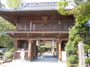
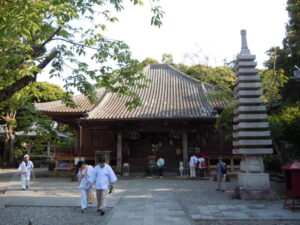
Temple 75 (Zentsu-ji) is especially famous as the birthplace of Kobo Daishi (Kukai) and attracts many visitors.
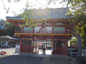
In addition, Temple 88 (Okuboji) is known as the final temple of the pilgrimage, marking the completion of the entire Shikoku route.
By using Google Maps, it becomes much easier to plan the final route and check surrounding facilities as you approach the conclusion of the pilgrimage.
On each temple’s detailed page, photos of the temple and links to Google Maps are provided.
These pages are useful not only for planning your pilgrimage in advance, but also for checking routes while you are on the road. Bookmarking them can therefore be very helpful.
In particular, for walking pilgrims, it is recommended to check not only the location of each temple, but also nearby convenience stores and accommodation facilities as part of your preparation.
Temple 66: Unpenji
| ◀ Prev Temple | Next Temple ▶ |
| 18.1 km | 9.4 km |
| Google Maps | MAP |
| Transport | – |
| Accommodation | Places to Stay |
Temple 67: Daikōji
| ◀ Prev Temple | Next Temple ▶ |
| 9.4 km | 8.7 km |
| Google Maps | MAP |
| Transport | – |
| Accommodation | Places to Stay |
Temple 68: Jinnein
| ◀ Prev Temple | Next Temple ▶ |
| 8.7 km | 0 km |
| Google Maps | MAP |
| Transport | – |
| Accommodation | Places to Stay |
Temple 69: Kannonji
| ◀ Prev Temple | Next Temple ▶ |
| 0 km | 4.5 km |
| Google Maps | MAP |
| Transport | – |
| Accommodation | Places to Stay |
Temple 70: Motoyamaji
| ◀ Prev Temple | Next Temple ▶ |
| 4.5 km | 11.3 km |
| Google Maps | MAP |
| Transport | – |
| Accommodation | Places to Stay |
Temple 71: Iyadaniji
| ◀ Prev Temple | Next Temple ▶ |
| 11.3 km | 3.7 km |
| Google Maps | MAP |
| Transport | – |
| Accommodation | Places to Stay |
Temple 72: Mandaraji
| ◀ Prev Temple | Next Temple ▶ |
| 3.7 km | 0.6 km |
| Google Maps | MAP |
| Transport | – |
| Accommodation | Places to Stay |
Temple 73: Shusshakaji
| ◀ Prev Temple | Next Temple ▶ |
| 0.6 km | 2.2 km |
| Google Maps | MAP |
| Transport | – |
| Accommodation | Places to Stay |
Temple 74: Kōyamaji
| ◀ Prev Temple | Next Temple ▶ |
| 2.2 km | 1.6 km |
| Google Maps | MAP |
| Transport | – |
| Accommodation | Places to Stay |
Temple 75: Zentsuji
| ◀ Prev Temple | Next Temple ▶ |
| 1.6 km | 3.8 km |
| Google Maps | MAP |
| Transport | – |
| Accommodation | Places to Stay |
Temple 76: Konkōji
| ◀ Prev Temple | Next Temple ▶ |
| 3.8 km | 3.9 km |
| Google Maps | MAP |
| Transport | – |
| Accommodation | Places to Stay |
Temple 77: Dōryūji
| ◀ Prev Temple | Next Temple ▶ |
| 3.9 km | 7.2 km |
| Google Maps | MAP |
| Transport | – |
| Accommodation | Places to Stay |
Temple 78: Gōshōji
| ◀ Prev Temple | Next Temple ▶ |
| 7.2 km | 5.9 km |
| Google Maps | MAP |
| Transport | – |
| Accommodation | Places to Stay |
Temple 79: Tennōji
| ◀ Prev Temple | Next Temple ▶ |
| 5.9 km | 6.6 km |
| Google Maps | MAP |
| Transport | – |
| Accommodation | Places to Stay |
Temple 80: Kokubunji
| ◀ Prev Temple | Next Temple ▶ |
| 6.6 km | 6.5 km |
| Google Maps | MAP |
| Transport | – |
| Accommodation | Places to Stay |
Temple 83: Ichinomiyaji
| ◀ Prev Temple | Next Temple ▶ |
| 11.9 km | 13.6 km |
| Google Maps | MAP |
| Transport | – |
| Accommodation | – |
Which Sections Are Actually the Toughest?
Shikoku Pilgrimage Difficult Areas Based on Distance and Elevation
On the Shikoku 88 Temple Pilgrimage route, temple-to-temple sections are often described subjectively, such as “the mountain paths are tough” or “Cape Muroto feels long.”
However, the actual difficulty can be evaluated much more objectively using two factors: distance and elevation gain.
In this article, we classify each segment between temples based on total walking distance and accumulated elevation gain, and organize the truly demanding sections of the Shikoku 88 Temple Pilgrimage route.
When we organize the 88 pilgrimage segments by distance and elevation gain, they fall into three types:
- Standard sections (approx. 77%)
- Mountain sections (approx. 14%)
- Long-distance sections (approx. 9%)
Rather than a simple “easy / moderate / difficult” classification, the key feature is that difficulty is split into two distinct patterns: steep climbing sections and long-distance walking sections.
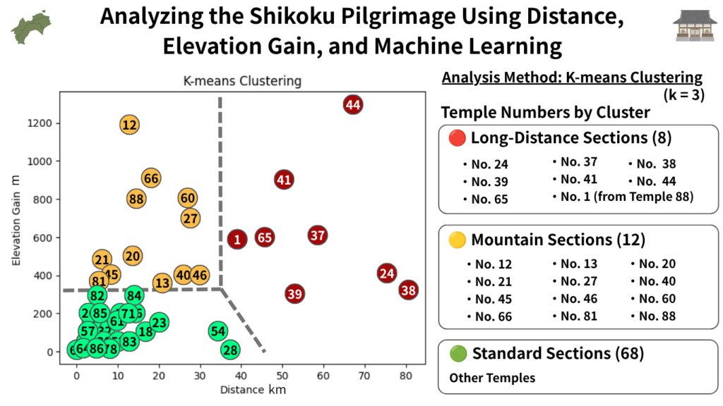
Standard Sections (approx. 77%) | The Core of the Route
Most temple-to-temple segments fall into this category.
- Number of segments: 68
- Average distance: approx. 6.4 km
- Average elevation gain: approx. 61 m
These sections generally have minimal elevation changes and represent the “standard walking conditions” of the pilgrimage. They are the most predictable and manageable for first-time pilgrims.
Mountain Sections (approx. 14%) | Short but Physically Demanding
These sections are not necessarily long in distance, but involve significant elevation gain and heavy physical strain.
- Number of segments: 12
- Average distance: approx. 17.6 km
- Average elevation gain: approx. 620 m
This category includes some of the most well-known difficult temples, where continuous climbing leads to exhaustion even over relatively short distances.
Representative sections include:
Shosan-ji, Kakurin-ji, Tairyu-ji, Kannon-ji, Yokomine-ji, Unpen-ji, Okuboji, etc.
Long-Distance Sections (approx. 9%) | Distance Itself Is the Challenge
These sections are not extremely steep, but the walking distance is significantly longer than average.
- Number of segments: 8
- Average distance: approx. 58.6 km
- Average elevation gain: approx. 625 m
These routes are difficult to complete in a single day and require careful itinerary planning. Many of them are concentrated around Cape Muroto and Cape Ashizuri.
Representative sections include:
Cape Muroto area, Cape Ashizuri area, and the Iwamoto-ji region.
Conclusion | Difficulty Is Defined by Either Hills or Distance
About 77% of the Shikoku Pilgrimage consists of standard walking sections.
The real difficulty comes from two distinct types of challenging segments:
- Mountain-type sections (elevation-driven fatigue)
- Long-distance sections (distance-driven fatigue)
In other words, pilgrimage difficulty is not uniform. Instead, it is important to distinguish between:
- sections that tire you through climbing
- sections that tire you through distance
This distinction is essential for planning a safe and realistic route.
This classification is based on a K-means clustering analysis using distance and elevation gain data. Detailed methodology is explained in a separate article.
Which is Better for the Shikoku Pilgrimage: Paper Maps or Smartphone Maps?
A common question when starting the Shikoku Pilgrimage is whether to use paper maps or smartphone maps.
The short answer is that both have advantages and disadvantages.
In recent years, more pilgrims have been using Google Maps on smartphones, but paper maps have not become unnecessary.
Especially for walking pilgrims, which can take several weeks or even months, it is important to understand the strengths of each and use them together effectively.
Advantages of Paper Maps
The biggest advantage of paper maps is that they are not affected by battery life or mobile signal conditions.
While smartphones are convenient, they can run out of battery or malfunction.
Paper maps, on the other hand, can be used at any time, making them a reliable backup in emergencies.
They also allow you to view the entire pilgrimage route at a glance, which is difficult on smartphone screens.
While smartphone maps are useful for checking your immediate surroundings, they may not clearly show the overall layout of Shikoku or the relationships between prefectures and temple clusters.
Benefits of paper maps:
- No battery required
- Works without mobile signal
- Easier to understand the entire route of Shikoku at once
- Allows notes and annotations
- Useful as an emergency backup
For long-distance walking pilgrims, it is still common to carry a paper map as a secondary tool alongside a smartphone.
Recommended Paper Map: “Shikoku Japan 88 Route Guide”
Among the most widely used standard paper pilgrimage maps, one of the most highly recommended is the “Shikoku Japan 88 Route Guide.”
This map book is designed specifically from the perspective of walking the Shikoku 88 Temple Pilgrimage, and it is widely supported by both first-time pilgrims and experienced travelers.
One of its biggest strengths is that it is not just a map—it is a guide filled with practical walking information. It includes detailed data such as distances between temples, elevation changes, key junction points to watch out for, and supply locations. These are pieces of information that are difficult to fully grasp using smartphone maps alone.
Another advantage is its structure: it is divided into regional booklets, making it easy to carry only the section you need. This makes it particularly suitable for long-distance walking pilgrims.
In mountainous areas especially, where mobile reception can be unstable, having a paper map like this greatly increases safety and peace of mind.
By using it together with smartphone maps, you can check your real-time location on Google Maps while using the paper guide to understand the overall route and upcoming terrain. This combination allows for safer and more efficient pilgrimage planning.
For official purchase and details, please visit here.
Advantages of Google Maps
The biggest advantage of Google Maps is that it allows you to check your current location in real time.
During the Shikoku Pilgrimage, it is common to get confused at junctions or when choosing routes in urban areas, but Google Maps lets you immediately confirm both your current position and your destination.
It also displays estimated travel times for walking, cycling, and driving, making it much easier to plan your pilgrimage schedule.
In recent years, an increasing number of pilgrims have been completing the entire pilgrimage using only smartphones, and its convenience is one of its greatest strengths.
Recommended Approach for Walking Pilgrims: Use Both
For walking pilgrims, the most effective method is to use both paper maps and Google Maps together.
During the actual walk, Google Maps is useful for checking your current location and navigating in real time. Meanwhile, when planning your pilgrimage route, paper maps or overall route maps are more effective for understanding the bigger picture.
In particular, the following maps included in this article provide information that is difficult to grasp using Google Maps alone:
For example, Google Maps can show you the route to the next temple, but it cannot easily tell you:
- Whether a steep climb is coming up
- How far the next convenience store is
- Whether the section is difficult to resupply in
Because of this, an ideal workflow would be:
- Check the overall route using a full map
- Understand difficult sections using an elevation map
- Plan supplies using a convenience store heatmap
- Use Google Maps for real-time navigation on-site
Rather than choosing between paper or smartphone maps, first-time pilgrims should focus on combining their strengths.
For a safe and comfortable pilgrimage, using multiple types of maps together is the most practical approach.
Related Articles
This article provides a complete list of the Shikoku 88 Temple pilgrimage route, including distances, travel times, and temple lodging (shukubo).
Temple List and Full Route
Shikoku Pilgrimage Convenience Store Map: Longest Supply Gaps for Walking Henro (2026 Guide).
Convenience Store Guide Map for Shikoku Pilgrims
Comments